Thanks to the challenge Open Data FWD, a lot of new mobility data became available for Amsterdam. Within this challenge, Waag and the DIVV Amsterdam are looking for open data applications that address urban mobility issues.
The challenge consists of three themes (Cycling, Parking and Public Transport). The best concepts win € 4,000 and the chance to create applications for the four largest Dutch cities. But what is an open data challenge without new open data? Time for an update.
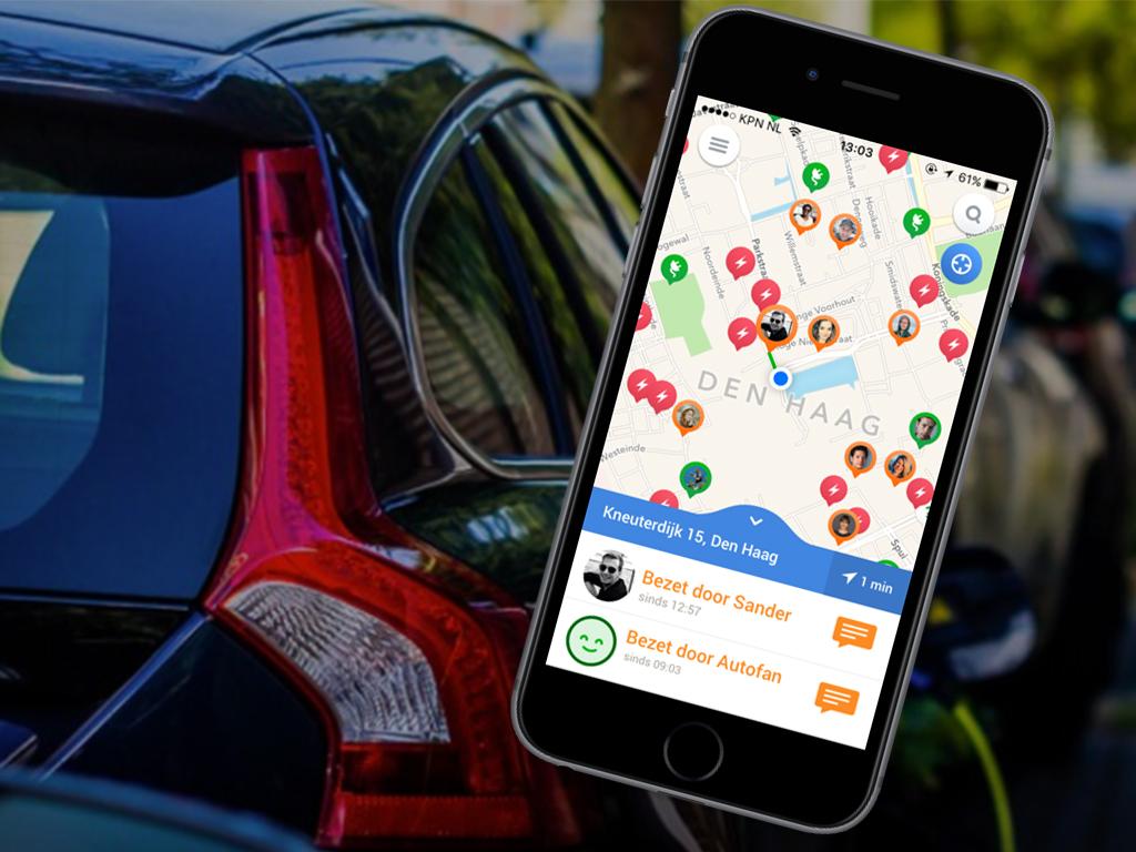
Special efforts have been made to open up more parking data. This new data is not only available in the original format, but also by using the standardized CitySDK API.
Parking Data & API
In a city like Amsterdam, parking is a complex and important issue for which a lot of data is collected. For the centre of Amsterdam, the historic utilization of street parking spots is now available. And for the entire city, we have opened up the following data:
- The location and real-time utilization of parking spots;
- The location of special parking spaces, for example for disabled people;
- The location of P+R sites;
- The costs associated with street parking zones and parking in a garage;
- The location of parking meters;
- The location of charging points for electric cars, with real-time information about the availability.
Developers company Glimworm has built a service (API) with the data that shows a visitor of Amsterdam how expensive parking at various locations in the city is. With this API, you could for instance built an application that shows a visitor of Carré if he can park in front of the theatre of if it's smarter to use the P+R site at the Arena and continue by public transport. In addition to this API a widget will soon be available.
Real-time traffic data
We’ve already opened up data about traffic flows of Amsterdam and are now working on this for the entire country, together with the NDW. We will make the data available via the LD API CitySDK and link it directly to the National Road Database. Moreover, information about traffic jams and working on the road will follow soon. Through the API data is available for:
- Bicycle parking, taxi stations and forecasts for air quality (untill 2030);
- The GIF images that the traffic control centre sends to the Dynamic Route Information boards (DRIP boards);
- For touring cars the routes and parking places are available.
Do you have questions about the data, the interpretation or usage? The specialists of the Dienst Infrastructuur & Vervoer are happy to help.