Heritage can be found everywhere. Not just in museum collections, presented at a nice location, or locked up in storage. Heritage is “old” (from the past), but it can also tell us a lot about the “new”—our current view of the world, our identity. Technology frequently plays a roll in the availability and presentation of our heritage both inside and outside the museum. By connecting it to our environment and our lives (and not isolating it), we can get a different (better?) perspective of our surroundings and of modern society.
Technology makes heritage come alive
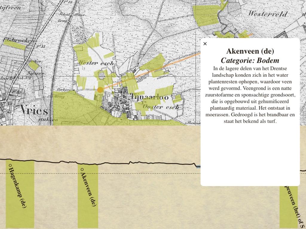
A lot of our heritage can be found on the streets, in the city, or in rural surroundings. By combining data sources, we can make more aspects visible. Think of all the names of places, streets, and areas that describe what happened at that particular location, or what it looked like in the past. For instance, Dutch place names ending in ‘broek’ are usually found either in low-lying areas that stay wet due to underground water or are located near small bodies of water (brooks!), which cause these areas to flood easily. Niene Boeijen, student at the Wageningen University, worked at Waag during her internship and made a tool that connects such place names to their geographical locations and altitude. This immediately helps to visualize the meaning of place names.
Her application is one of the many proposals of the Heritage & Location project to do more with the geographical accessibility of our heritage. The challenge in doing so is that historical names do not correspond with their modern equivalents, think of ‘Amstelredamme’ for Amsterdam or old streets that have disappeared or which course were altered. What we need is a harmonization and standardization. In the project, new public concepts were developed: What if you connect locations to the civil register? Or could you relive the romantic travel literature from the 19th century with a virtual cycling or walking tour and ask yourself: what is the difference between then and now?
GPS routes
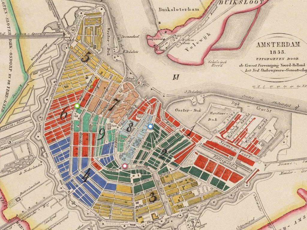
In this way, by using smartphones with GPS or iBeacons, some routes can already offer content on location, to inform tourists or citizens about the location and what they may see there. NiNsee developed such a route with the MuseumApp for the history of Dutch slavery. Many spots in Amsterdam remind us of that part of our history. Think of the warehouses, the headquarters of West-Indian Compagnie, the decorations of merchants houses on the Amsterdam canals, and also the statue of Anton de Kom in the Southeastern quarter. Interactive technology can activate participants, too. A recent concept created by young professionals on the same theme was “#DecolonizeTheMuseum;” a twitter campaign in which visitors can de-colonize places, documents, and collections. The context of this concept is a recent co-creation project with (among others) the Museum voor Wereldculturen, that researches the relations between museums and the youth hands-on.