Everyone can participate in an online initiative to connect 5.000 old maps of Amsterdam to their geographical coordinates. This has partly emerged from the 'Heritage & Location' project in which Waag participates. After just one week, already 40% of the reference points have been received (but still need to be checked, of course).
What is the purpose?
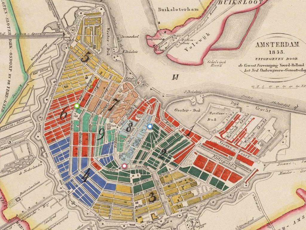
The map collection of the city archive of Amsterdam has been described, but is not yet connected to geographical coordinates. By georeferencing the historical maps, they are literally placed on a modern map of the city. Georeferencing is relatively easy to do, by placing a marker on the historical map and then placing a second marker on an overlay with a modern map. By placing at least three markers on both maps, the position can be determined.
All available digital maps of Amsterdam can be used in this project. More information can be found here (in Dutch).
Interested to start with georeferencing other maps yourself? The source code is open source and can be found at Github.