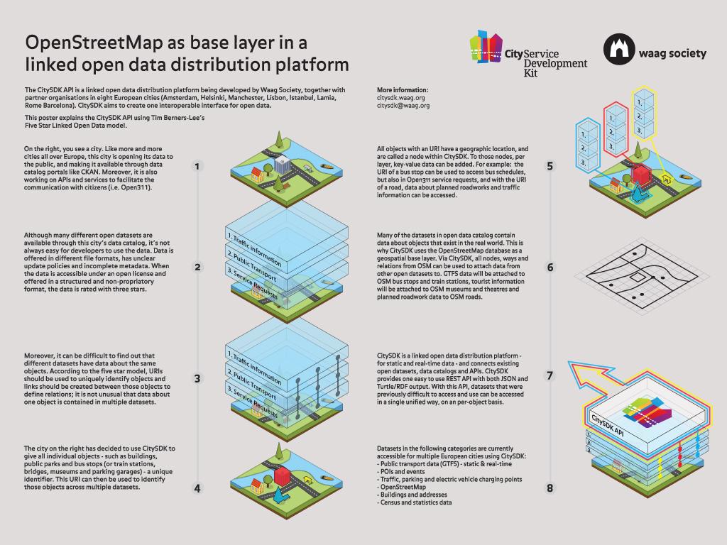
Why did Waag develop the CitySDK? Governments are producing lots of information and this data is no mostly open for wider application. From city councils to national governments and the European Union: they all produce an enormous diversity of data. All of them with their own targets and means, from every specific part of the society.
The result? Thousands of websites with long lists of available datasets. A big step for mankind, especially from a democratic and civil service point of view. But whoever wants to use this data faces many problems: different data formats and refresh terms (once a week or once every three years?), data that suddenly is being transferred to another location (for a 'better' experience) and everyone is measuring and registering in their own way.
We tried to solve this in CitySDK. This API helps to open up data, provides essential tools for developing digital services in the city, and ensures that you can quickly make the most of the ever-growing technical possibilities. And because the platform allows for crowd-sourced data, it also facilites digital interaction amongst citizens themselves and between citizens and government.