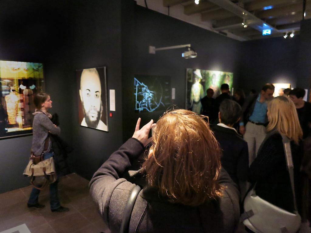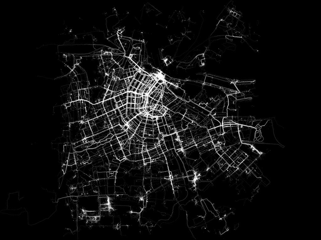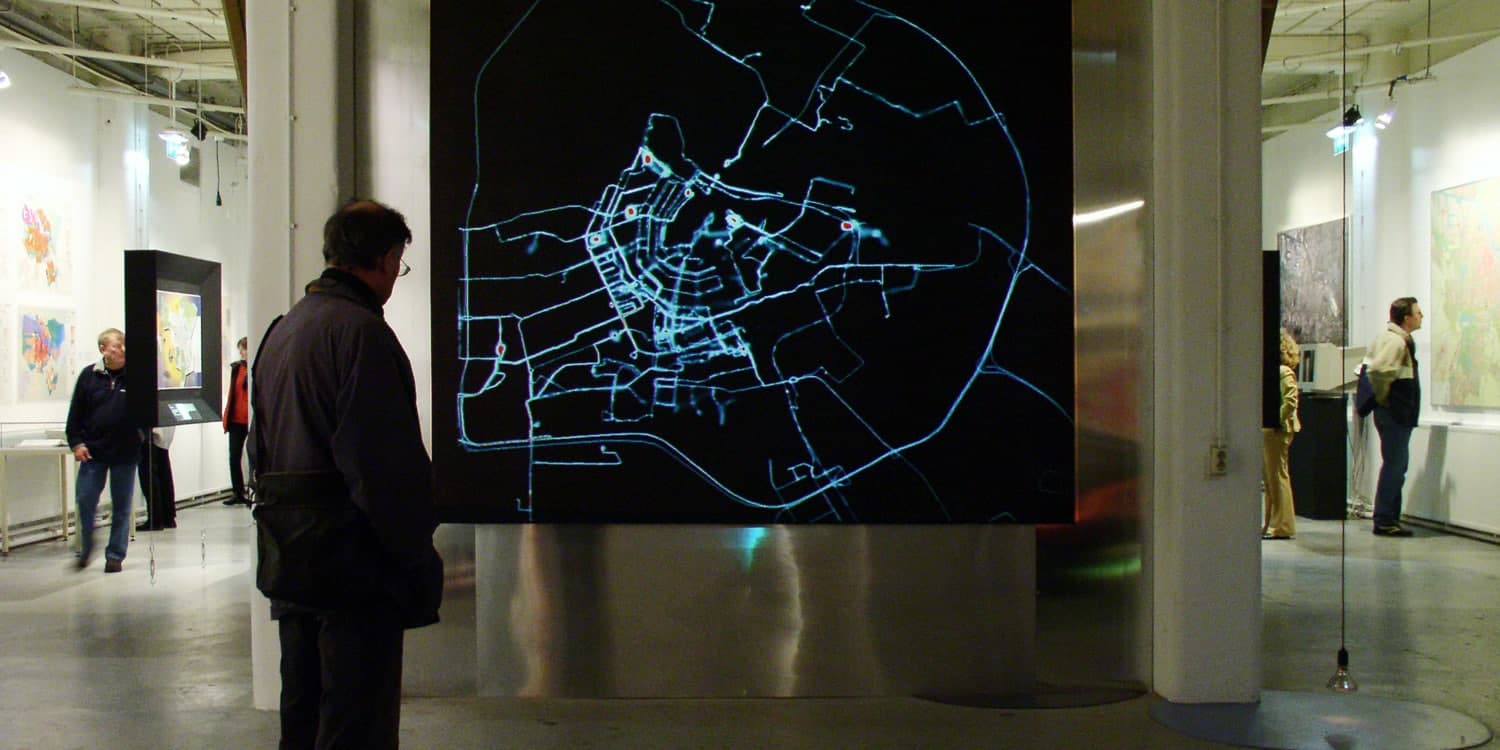
For the exhibition “Maps of Amsterdam 1866-2000” at the Amsterdam Municipal Archives, Waag, Tom Demeyer, Esther Polak and Jeroen Kee developed the installation AmsterdamREALTIME, which uses modern technology to explore a new method of cartography. The media art project playfully demonstrated how GPS technology would change human orientation and spatial perception, years before the widespread introduction of smartphones and commercial navigation services. The project revealed how Amsterdammers experience and shape their city through movement, and has since become an important reference point in media art and thinking about mobility, landscape and cartography.
More than twenty years later, AmsterdamREALTIME is being restored: the original Flash-based animation from 2003 and the accompanying web platform are being made accessible again in accordance with contemporary technical standards. This restoration not only offers the opportunity to preserve a crucial work in the history of digital culture, but also to re-examine the project in light of current issues surrounding datafication, privacy, digital infrastructures and spatial experience.
During this evening at Waag, we will discuss digital art, the development of location technology, mobility, digital cartography, and their social and cultural impact.
The speakers are: artist Esther Polak, designer Bente van Bourgondiën, professor of urban mobilities Marco te Brömmelstroet, former participant Merel Roze, and digital cartographer Bert Spaan. Moderated by Associate Professor in New Media Studies Michiel de Lange. Finally, there will be a public screening of the restoration of AmsterdamREALTIME and archive material.
During Waag Open, the restoration of AmsterdamREALTIME can be seen in an exhibition at Waag.
Programme
| 19:30 - 19:45 hrs | Welcome & introduction |
| 19:45 - 20:15 hrs | Esther Polak about AmsterdamREALTIME |
| 20:15 - 21:30 hrs | Talk between Esther Polak, Bente van Bourgondiën, Marco te Brömmelstroet and Bert Spaan |
The AmsterdamREALTIME installation will also be exhibited at Stadsarchief from 24 March to 14 June.
Accessibility
If you are on a tight budget and would like to participate in this event, please contact sanna ⟨ at ⟩ waag.org.
The Waag building is not accessible to visitors with reduced mobility. View our accessibility information here.